rayshaderでDEM+GPSデータ可視化 #2

#1のつづき
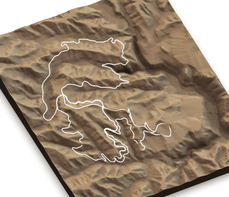
前回は地理院のDEM+GPSデータを3Dで可視化するところまでできた。
では、はじめてrayshaderについて知った時のような動画にする。
‼️New #rayshader release (v0.32.5)! This version brings 3rd person views to your maps, generated directly from a spatial path: turn your GPS bike rides/runs/hikes into cool 3D animations, directly in #RStats! You can even steady the camera or add rotation for a cinematic effect. pic.twitter.com/rYE2dG6n75
— Tyler Morgan-Wall @tylermorganwall@fosstodon.org (@tylermorganwall) December 13, 2022
動画にする
上記Twitterのコメント欄にあったリンクから
convert_path_to_animation_coords()によって可能と説明されている。
やってみた。
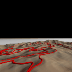
その1
関数の名前だけかえ、コード例を実行したのみ。
まずは、パスをたどる視点で。
zscaleだけ、パスのものと同じにした。
するとTempファイルに25枚写真が保存された。(tempdir()でパスがわかる)

https://syncer.jp/gif-makerでgifにすると以下のような感じ。フレーム数が少なすぎて、よくわかんけど、とりあえず何かできた。
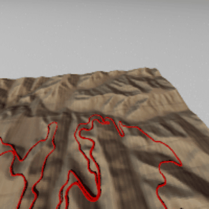
その2
パスを、第三者からの視点で。
follow_camera = TRUEだけでよい。すると以下のように。

おなじくGIFにすると
小括
改善の余地あり!
この記事が気に入ったらサポートをしてみませんか?