Memories of ”Locomotives on the shore”: What we can do to carry on the local history

The ”TokyoYard PROJECT” is part of the Shinagawa Development Project undertaken by the JR East in the area surrounding Takanawa Gateway Station area. This series of “note” aims to introduce you to the context and process of the development, as well as our philosophy behind its city planning.
https://note.com/tokyoyard
In this post, we will report on the current status of the survey and our policy regarding the survey and preservation of the “Takanawa Embankment” (hereinafter called embankment), which was excavated from under the railways after the track replacement in November 2019, as well as how the site will be utilized in the new city. Niinuma of the JR East Shinagawa Development Project team is here to tell you all about it.
Note : The status of the survey is as of August 2021.
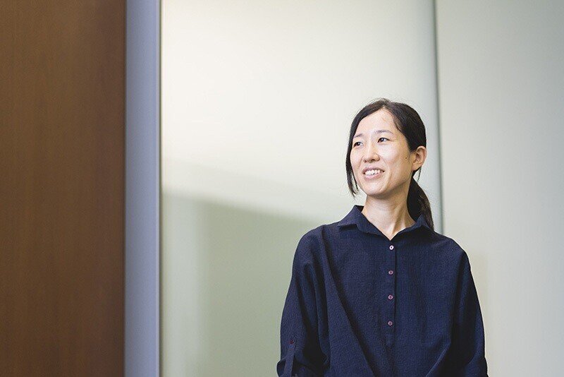
Sachiko Niinuma
Shinagawa Development Planning Project Team, Shinagawa & Large-scale Developments Department, Corporate Planning Headquarters. After joining East Japan Railway Company in 2007, Niinuma had been in charge of the planning and design for Tsujido Station and Chiba Station, as well as the construction of Takanawa Gateway Station. Since May 2021, she has been in charge of survey and preservation of the Takanawa Embankment at her current position. Since being in charge of the embankment, she has started to notice the differences in structure of stone walls in various places, and has come to understand the greatness of Tamori*.
(*Tamori is a Japanese comedian / TV host who is known for his profound knowledge in geology and history. He hosts an educational entertainment show called BURATAMORI, which has previously focused on various historical stone walls in Japan.)
“Locomotives on the shore”, a symbol of civilization and enlightenment
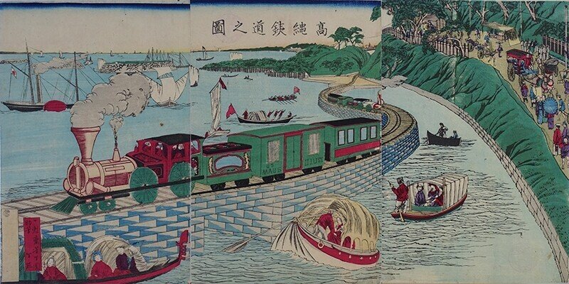
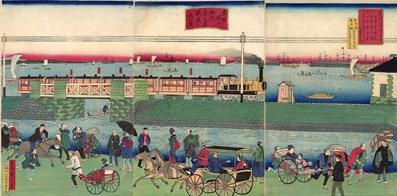
Takanawa Embankment / Yoshitoshi Tsukioka, “Perspective picture of Takanawa Railway” circa 1871 (Meiji 4), courtesy of Minato City Local History Museum
The Takanawa Embankment is a railroad structure built to lay tracks on the sea when Japan's first railroad was opened in 1872 (Meiji 5). One theory holds that the Ministry of War at the time refused to hand over the site to the railroad authorities on the grounds that it was necessary for national defense. Hence, the railroad had to be built on sea instead of on land.
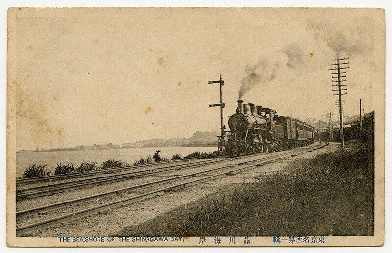
It is said that the trains, which ran over the 2.7 kilometer long embankment from Honshiba (currently known as Tamachi Station) to just before Shinagawa Station, was familiarly called as “locomotives on the shore” and was depicted in numerous Nishiki-e (colored woodblock prints) of the time.
Since then, the embankment was reclaimed with the construction of cargo handling areas and train depots before World War II. And for a long time, it was lying underneath Yamanote Line, Keihin-Tohoku Line, and train depots until it was unearthed after the track replacement work in 2019.
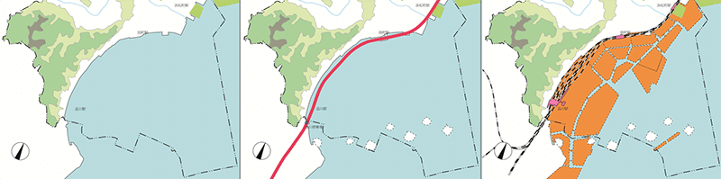
Image courtesy of Minato City Local History Museum
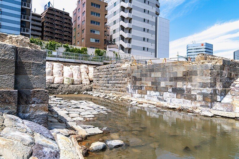
Part of the Takanawa Embankment was discovered during the construction work around Shinagawa Station in April 2019. Although it has been inferred from historical documents that the embankment once existed, it was believed to have been lost during pre-war land reclamation. And since there were existing railroad tracks, elevated bridges, and train depots on the reclaimed land, we had not been able to survey the area until now.
However, as a result of the exploratory excavation after the unearthing, it was confirmed that the embankment had remained in good condition, which was honestly an unexpected event for us as well.
Preserving the Takanawa Embankment
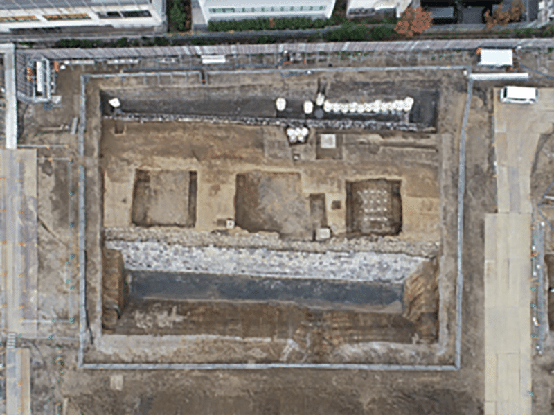
The first phase of the new city under Shinagawa Development Project is scheduled to open in 2024, and the city will consist of Block 1 to 4. The embankment excavated close to the development site is extremely valuable as ruins that symbolize the modernization of Japan in the Meiji era**. Following the unearthing of the embankment, JR East established the Takanawa Embankment Survey and Preservation Committee (hereinafter called committee), which is currently discussing policies regarding the survey and preservation with experts from various fields such as archaeology, history, civil engineering, railroad history, as well as the government.
(**Meiji era is an era of Japanese history that extended from 1868 to 1912, where Japan moved from being an isolated feudal society to the new paradigm of modern and industrialized nation state, influenced by the west.)
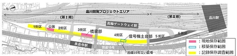
JR East News, April 21, 2021 (Caption: Pink highlight - Scope of on-site preservation, Blue highlight - Scope of preservation via relocation, Yellow highlight - Scope of documentation and preservation survey)
Topics of discussion at the committee are diverse. How are we going to preserve and relocate the embankment after surveying the actual size and the condition of the ruins as well as detecting the planned building area? How will it concern the existing building construction plan? What steps should we take in conducting the survey in the first place?
Through repeated discussions from a wide range of perspectives, we have been trying to find a balance to achieve both the development of the city and the preservation of such culturally valuable ruins. The following are the policies that have been compiled as a result of the discussions.
(1) About 80 meters of the embankment in Block 3, including the bridge section, will be preserved on site.
(2) The remaining 40m of the embankment adjacent to the park in Block 2, which is in good condition, will be preserved on site.
(3) About 30 meters of the embankment in Block 4, including the foundation of the traffic signals, will be relocated for preservation.
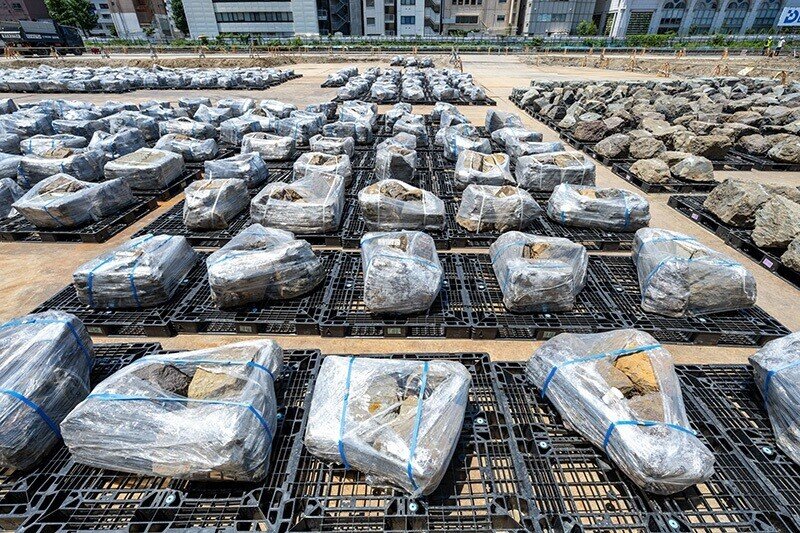
(4) Carry out a detailed and careful survey regarding the areas to be recorded and preserved.
As for areas requiring detailed and careful investigation, stone walls and wooden stakes are being numbered and their location, material, weight, length, etc. are recorded for future reference. In addition, technologies like drone photos are being used to digitize them for future restoration. The soil profile is also recorded according to the location, as well as the type of soil used in each location.
Furthermore, point cloud data*** of the embankment is also being recorded, with the aim of archiving the ruins more accurately and communicating its value to the public in the future.
(***Point cloud data is a 3D data consisting of information such as geotag, asperity of the space, colors, etc.)
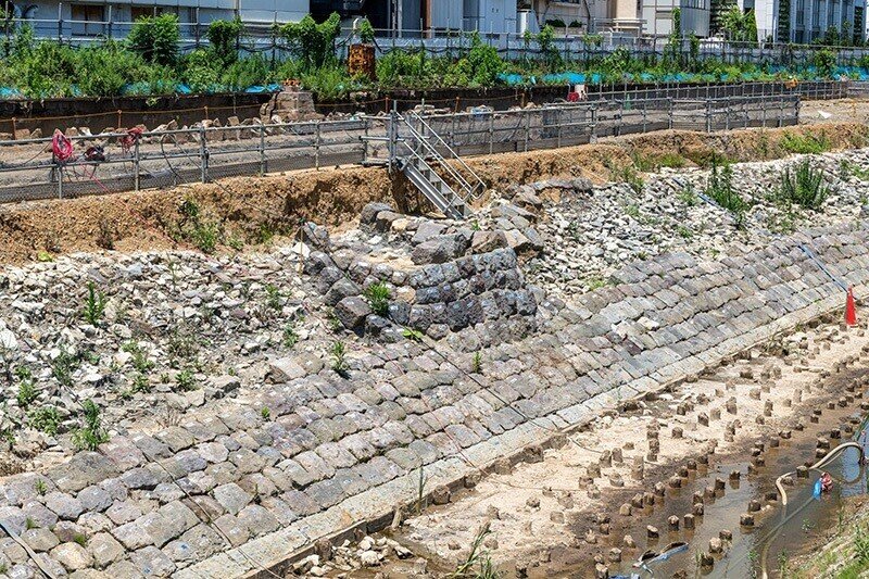
Footprints of Japanese- and Western-style civil engineering in the stone walls (Block 3)
From here, we will introduce to you the current status of the survey and what we have learned from it so far, focusing on Block 3 and 4, which have been chosen as locations for preservation of the traffic signal and the bridge section on site and via relocation.
The survey is being conducted in cooperation with the Minato Ward Board of Education, which plays a key role in this project, and with the advice of specialists.
Bridge section of the Takanawa Embankment / Utagawa Hiroshige III, ”Steam Locomotive Train Running near the Sea at Shinagawa, Tokyo” circa 1872-73 (Meiji 5~6), courtesy of Minato City Local History Museum
The “7th Bridge” excavated in Block 3 will be preserved on site and opened to the public after the initial opening. This bridge was built so that local residents' boats could go in and out of the seaward side from the landward side for fishing and transporting commercial goods at that time. 4 bridges from the 5th to the 8th are believed to have been installed on the sea.
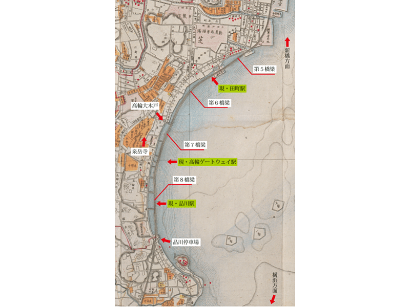
Map of Meiji 11 (Map of Tokyo, Meiji 11 (1878), Geographical Bureau, Ministry of Home Affairs), courtesy of Minato City Local History Museum (Caption: From top - Toward Shinbashi, 5th Bridge, currently Tamachi Station, 6th Bridge, Takanawa Great Wooden Gate, 7th Bridge, Sengaku-ji, currently Takanawa Gateway Station, 8th Bridge, currently Shinagawa Station, old Shinagawa Station, toward Yokohama)
Before looking closer at these bridges, let us first explain how the embankments are constructed. An investigation of the structure regarding the embankment can be considered as a valuable source of information on the civil engineering technology of the time.
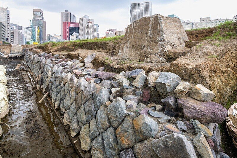
It is assumed that the core of the embankment was reclaimed with earth and sand, then embanked, and stone walls were piled up on seaward and mountain sides. We also found that these stone walls are built in two different methods. The stone walls on the seaward side are gently sloped to reduce the effects of waves, and the stones are laid one by one in “fabric laying” style, while those on the mountain side are almost vertical, and the stones are piled up diagonally in ”valley laying” style.
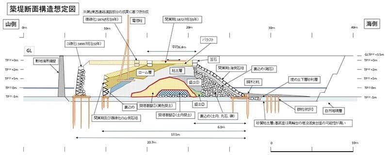
Drawing of the assumed internal structure of the stone walls, courtesy of Minato City Local History Museum
In the previous excavation, another stone wall was found in the embankment, which is believed to be a stone wall on the mountain side built when the railroad was opened in 1872. It is speculated that this stone wall was buried when the existing line was widened to three lines in 1899 (Meiji 32).
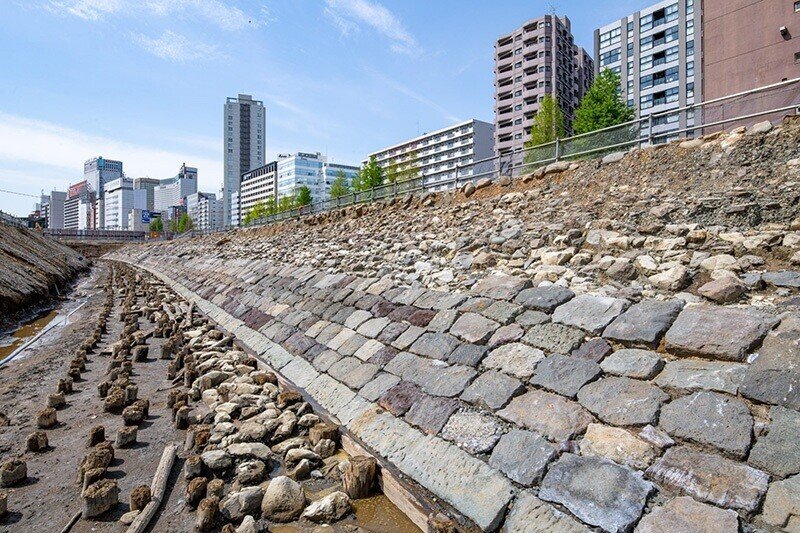
Stone wall on the seaward side, Block 4 (fabric laying)
Stone wall on the seaward side, Block 2 (valley laying)
The early construction of the embankment was carried out under the guidance of British engineer Edmund Morel. Hence, modern Western techniques such as “fabric laying” style, which uses punched stones, was adopted, but at the same time, Japanese conventional civil engineering techniques were also used for the backfills that secure these stone walls. After the widening of the rail line mentioned earlier, the stone walls were now piled in ”valley laying” style, which is an ancient Japanese stone laying method often seen in stone walls of castles, indicating the fusion of Western and Japanese civil engineering techniques.
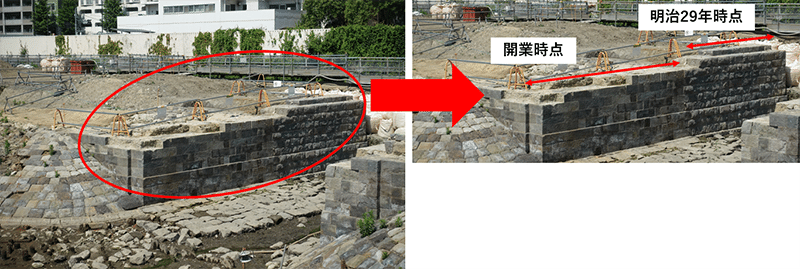
Abutment of the 7th Bridge, courtesy of Minato City Local History Museum (Caption: Left - Time of the opening, Right - Meiji 29 (1896) )
In the bridge section, there are also traces of the opening of the railway and its widening to three lines. It is believed that the surface of the stone at the time of the opening was smoothened in a “Sudare (bamboo blind)” style, while the stone walls at the time of the widening are roughly punched.
The bridge section is currently being backfilled to prevent weathering and deterioration.
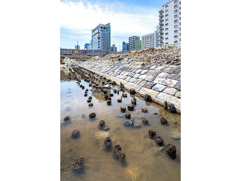
Numerous ”pile groups” were also found in the shallows, piercing the bottom of the embankment to about 2 meters. It is said that these pile groups, mainly made of pine trees, were used to strengthen the foundation and reduce the force of waves. In addition to these pile groups, the furring strips under the stone walls have not deteriorated due to being immersed in groundwater and still remain in very good condition. We plan to carefully survey and document these tinders as well.
Excavation of traffic signal ruins (Block 4)
The stone walls used in some parts of the embankments are believed to have been made from the stone walls of Daiba and Takanawa Beach, which were cut using chisels by craftsmen of the time. In this area, the embankment continues in a gentle curve from north to south.
On the other hand, although the ruins on the mountain side have not yet been confirmed due to the existing buildings, we have been able to detect some stone walls on this side as well. Also, as with the 7th Bridge section mentioned earlier, we were able to confirm that the embankment in Block 4 also used valley laying on the mountain side when the railway was widened to 3 lines.
These stone walls, except for those to be preserved on site, will be dismantled after the completion of the survey and documentation, but they will be carefully preserved as they are planned to be used for relocation and restoration.
The foundation section of the traffic signal, which is to be relocated and preserved, was located at the transition point from straight to curved, and was positioned so that it was easily visible from both directions of the railroad.
The details of how the signal was operated are not clear, but according to the documents at the time, it is believed that the signal had a wire attached to it, which was pulled to physically raise and lower the arms
Postcard of Shinagawa Coast Signal, Tokyo Sight First Collection, courtesy of Shinagawa Historical Museum
Foundation section of the traffic signal
In addition to the embankment, many other items that remind us of the livelihood of the time, such as wooden clogs, toothbrushes, glass milk bottles, and bowls used for station lunches, have been excavated from the area that used to be the sea. Since Shimbashi Station, the terminal station of the line, was close by, it is believed that passengers may have dumped these items from the trains into the sea. Furthermore, gravestones and other objects were found in the backfill soil. The reason for this is that the backfill soils are believed to have been brought from various different places.
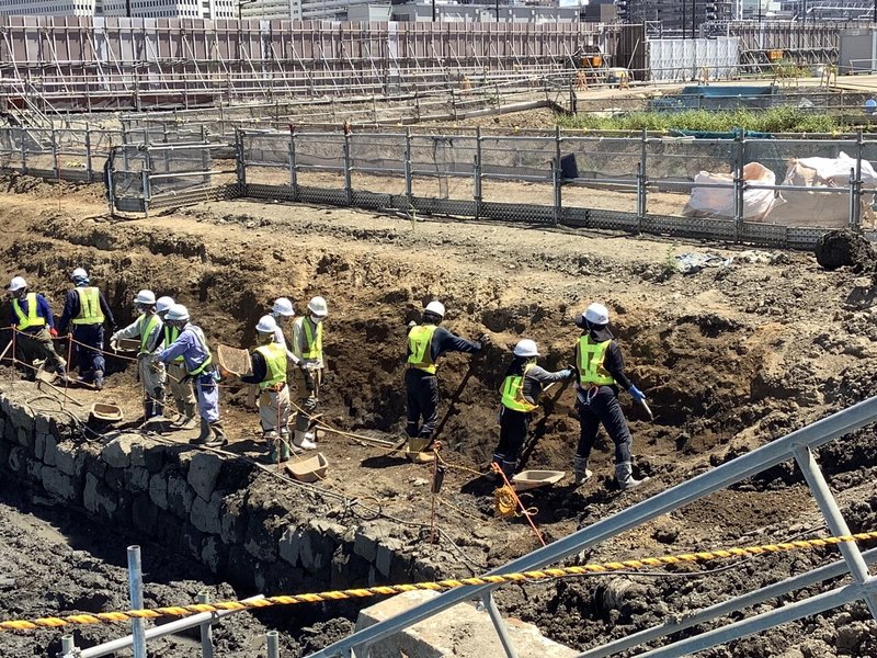
Although some of these excavations can be carried out with heavy machinery, the same method cannot be applied to all. If the soil layers are different or new ruins are found, they must be carefully excavated by hand with brushes in order to record the findings. Among the artifacts excavated, those with high historical value will be partially preserved for posterity.
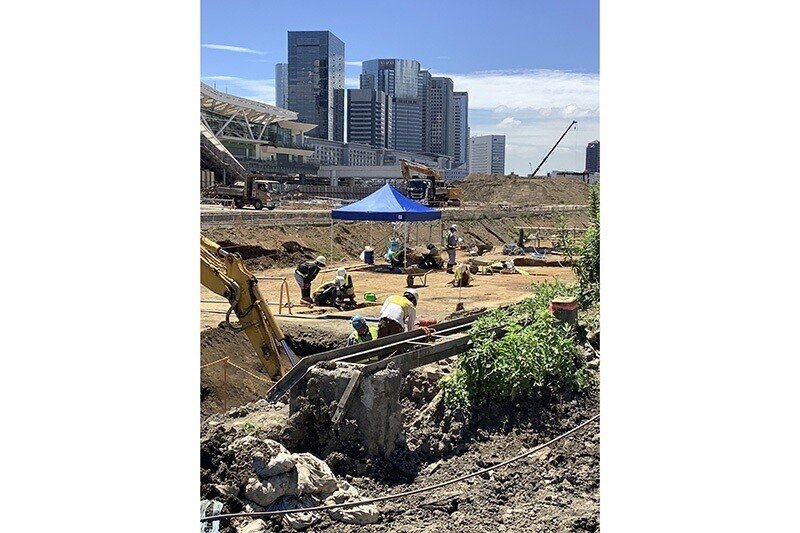
The survey and preservation work is being carried out under the supervision of the Minato Ward Board of Education, which plays a key role in this project, with the advice and guidance of experts, and the structure of the embankment is still being surveyed. We are making new discoveries every day and are watching the progress of the survey with great interest.
Ruins being cleaned under the tent (rail ties were being cleaned at the time of the interview)
Excavation work in progress
Utilizing the preserved embankments on site and via relocation
We are planning to utilize the ruins that have been preserved on site and via relocation in various ways for the new city that will be built.
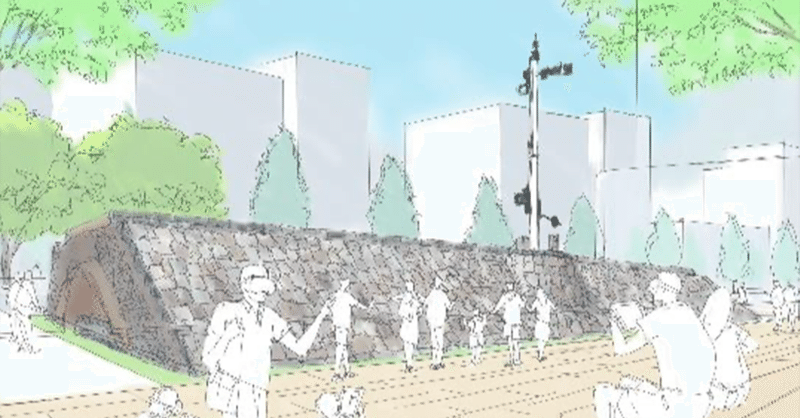
As for the 40-meter embankment in Block 2, which will be preserved on site, we would like to open it to the public so that people can feel it close at hand, in the area adjacent to the park by the cultural creation facility, which is the center of cultural transmission.
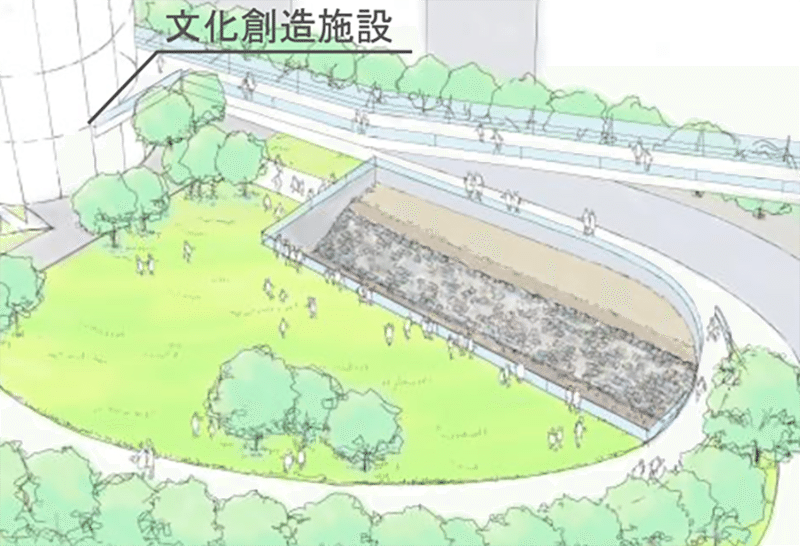
Image illustration of the public display (Caption: Cultural creation facility)
In addition, we are considering opening the 80-meter of the embankment, including the bridge abutment to be preserved on site, to the public so that they can have a view of it from the deck that will be installed around the site.
There are many technical issues that need to be solved before on-site display, from the standpoints of preservation of the embankment and people’s safety, and we are planning to keep studying them down the road.
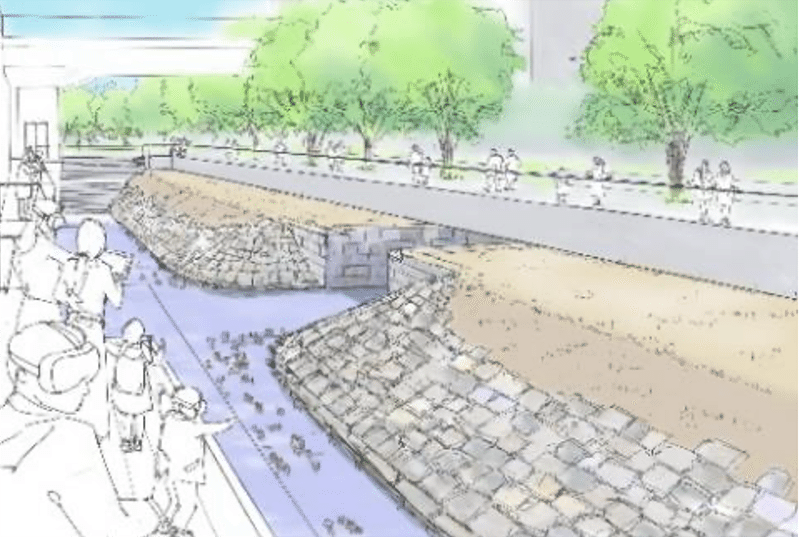
Image illustration of the public display
The 30-meter section, including the foundation of the traffic signal, will be relocated to the Takanawa Gateway Station plaza in Block 4, not far from the excavation site, where it will be restored to the way it was actually operated at the time and opened to the public.
We would like to discuss with experts on the ways of restoration and opening it to the public via relocation, taking safety of the people and deterioration of the ruins into consideration.
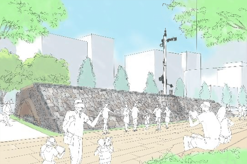
Image illustration of the public display
We are also considering utilizing the dismantled embankments, other than the ones that will be relocated and preserved on site, both inside and outside of the new city.
For example, we would like to see if we can incorporate the stones that have been surveyed into stone benches, if we can leave traces of the embankment in floorings, if we can have people trace the former coastline, etc. We would like to incorporate the memory of the embankment into the first phase of the city in a continuous fashion by utilizing them at the sites of excavation. At the same time, we are also considering the implementation of programs that allow visitors to learn about the history and local culture for the opening of it. One example of the program is the recreation of the landscape at that time via advanced technologies like VR and AR, enabling the simulation of Takana Embankment and the time of the railway opening. We are also thinking of using GPS to create a gimmick for people to get around and enjoy the area.
Furthermore, as we are planning to implement conventional and conferencing function for the new city, we are also considering the possibility of promoting the new city as a ”unique venue****” for holding conferences at historical and cultural facilities.
(****Unique venue refers to the use of museums, art galleries, historical buildings, and cultural facilities for events such as conventions, receptions, conferences, etc. It is part of a cultural project run by the Agency for Cultural Affairs and Japan Tourism Agency.)
The excavation of the embankment was an unexpected event for us at JR East, but it also gave us an opportunity to think seriously about what we can do with these historical ruins, and how we can contribute to the history and value of the area and pass it on to the next generation, rather than just surveying and preserving it for public viewing. We would like to preserve the embankment for future generations as a new asset for the new city and the area, fostering civic pride among local residents and providing an opportunity for visitors to learn about and love the city.
*The above images are for illustrative purposes only and are subject to change.
Reporting partner: Sachiko Niinuma of JR East
Interview and Edit by Takuya Wada
Additional photos and images provided by Minato City Local History Museum and Shinagawa Historical Museum
Photograph by JR East
Translation by Keitaro Takama
Content Direction by blkswn publishers Inc.
#TokyoYard #TokyoYardPROJECT #TakanawaGatewayStation #urbandevelopment #Tokyo #TakanawaEmbankment #survey #society #community #culturalcreation #history #local residents #civicpride #uniquevenue
この記事が気に入ったらサポートをしてみませんか?